


RelatedPosts
In its latest ENSO assessment for June 2026, the India Meteorological Department stated that sea surface temperatures in the central and eastern equatorial Pacific have risen beyond the +0.5°C threshold in the Niño 3.4 region, formally marking the onset of El Niño conditions. More significantly, the department underlined that atmospheric circulation patterns have now responded in tandem with oceanic warming, confirming that the system has transitioned into a fully coupled phase.
This coupling is critical. It signals that the warming is not superficial or transient but structurally embedded in the ocean–atmosphere system, increasing the likelihood of persistence and further intensification through the monsoon months.
Strong subsurface warming reinforces developing event
IMD data also point to strong positive temperature anomalies beneath the ocean surface across large parts of the equatorial Pacific. These subsurface heat signatures are widely regarded in meteorological analysis as leading indicators of surface warming, suggesting that the El Niño event still has energy to build upon in the weeks ahead.
Forecasts from the Monsoon Mission Coupled Forecast System indicate that the event is likely to intensify into a moderate-to-strong El Niño episode as the season progresses. Model guidance consistently shows sustained warming across the central Pacific during June to August, with expansion into the eastern Pacific from July onwards.
Monsoon vulnerability returns to focus amid sowing season
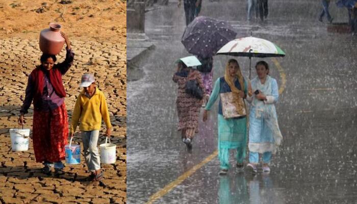
For India, the timing of this development is particularly consequential. The southwest monsoon is the backbone of the country’s agricultural economy, and any disruption in rainfall distribution during this phase can ripple through sowing cycles, yields and rural income.
El Niño events have historically been associated with weaker monsoon performance, prolonged dry spells, erratic rainfall and higher-than-normal temperatures. While outcomes vary year to year, the statistical association has kept policymakers alert, especially when the event strengthens during peak monsoon months.
With kharif sowing underway, the signal from IMD has immediate operational implications. Authorities are expected to focus on 197 districts identified as highly vulnerable to El Niño-linked rainfall stress. Contingency planning in these regions typically involves a shift towards drought-resilient crop varieties, increased emphasis on millets and pulses, improved irrigation efficiency, and expanded use of weather-based advisories for farmers.
Indian Ocean remains neutral, but regional balancing act uncertain
Complicating the forecast picture is the state of the Indian Ocean Dipole (IOD), which currently remains neutral and is expected to stay so through much of the monsoon season. A neutral IOD generally does not exert a strong corrective influence on monsoon behaviour, leaving El Niño’s impact relatively uncountered in large parts of the seasonal window.
However, the Japan Meteorological Agency has suggested the possibility of a positive IOD emerging around July, which could partially offset El Niño’s suppressing influence on rainfall. Japan Meteorological Agency has indicated that such a shift, if it materialises, may soften the severity of monsoon disruption in some regions.
The IMD has emphasised that it will continue to track evolving ENSO dynamics closely and issue monthly updates as the season progresses. Given the interaction of multiple climate drivers at play, the coming weeks will be crucial in determining whether the monsoon merely weakens in patches or enters a more prolonged phase of variability.