


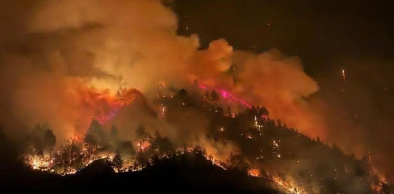
A big forest fire erupted early on Thursday in Nadipar in Arunachal Pradesh’s West Kameng district, which is under the Dirang subdivision, burning acres of land and posing a threat to surrounding villages. The fire was intensively propelled by strong winds and soon spread towards Zimthung village, triggering a large-scale and immediate firefighting operation.
Troops of the Indo-Tibetan Border Police (ITBP), Sashastra Seema Bal (SSB), police, and Bomdila fire services worked in collaboration with local people to limit the fire, in spite of unfavourable weather. Firefighting continued into Thursday evening, with strong winds continuing to complicate containment.
Massive forest fire engulfs Dirang town in Arunachal Pradesh, India!
The situation is dire, with flames spreading rapidly.
Firefighters on the ground, battling the inferno.#ArunachalPradesh #ForestFire #India pic.twitter.com/0apE1M23Iy
— Facts Prime (@factsprime35) April 24, 2025
However, Dirang MLA Phurpa Tsering assured the public that the situation was under control. “We are working around the clock with all available resources,” he said.
Why Did This Happen?
Experts warn that such forest fires are becoming more frequent across India, particularly in ecologically sensitive regions like the Northeast. March to May is the period of highest incidence of forest fire, and it is brought on by climatic as well as anthropogenic causes.
The hot weather, tinder dry vegetation, and strong gusts create ideal conditions for burning. Jhum cultivation practices also present a hazard.
It has been reported by Ahmad et al. (2018) that almost 73% of the forest fires in the state happen during March and April. A recent satellite analysis identified a dozen important factors controlling wildfire outbreaks such as forest condition, canopy density, temperature, rainfall, and human activity. The research highlights the intricate interaction between land use and environmental conditions that render areas such as Dirang more prone to destructive fires.