
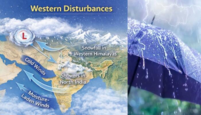
A major weather system driven by an active western disturbance has triggered widespread rainfall, thunderstorms, lightning and gusty winds across large parts of India from today, with the India Meteorological Department warning of continued instability over the coming days. Several regions across north, central, eastern and parts of southern India are expected to remain under the influence of this system, raising the risk of localised disruptions while temporarily easing rising temperatures.
Delhi-NCR under alert as rain and gusty winds intensify
The national capital and surrounding regions are set to witness a fresh spell of unsettled weather today and tomorrow (March 20), with forecasts indicating cloudy skies, thunderstorms, lightning and intermittent spells of light rain. Initial drizzle is likely in the forenoon, followed by one or two spells of rain later in the day.
Wind speeds are expected to range between 30 and 40 kilometres per hour, with gusts touching 50 kilometres per hour during intense activity. The advisory extends across the wider NCR, including Noida, Gurugram, Ghaziabad and Faridabad, where similar conditions are likely. The shift follows strong winds and heavy rainfall that swept parts of Delhi on Wednesday evening, signalling a continued wet phase.
Telangana braces for intense thunderstorms and gusty winds
Hyderabad and neighbouring districts such as Ranga Reddy and Medchal-Malkajgiri are likely to experience moderate rainfall under persistent cloud cover. The ongoing showers have already lowered daytime temperatures by 3 to 4 degrees Celsius, offering relief from early summer conditions.
However, the department has warned of severe thunderstorms accompanied by gusty winds reaching up to 50 kilometres per hour across several districts, including Bhadradri-Kothagudem, Khammam, Mahabubabad, Suryapet, Jangaon, Yadadri-Bhongir, Nalgonda, Hanmakonda, Warangal, Mulugu, Bhupalapally, Medak, Nagarkurnool and Wanaparthy. These conditions are expected to intensify through the evening and persist into the night, increasing the likelihood of local disruptions.
Ahmedabad sees brief respite before heat returns
Ahmedabad is expected to witness partly cloudy skies with chances of light rain and thunderstorms, with daytime temperatures around 36 degrees Celsius and night temperatures near 23 degrees Celsius. Across Gujarat, temperatures are likely to dip by 2 to 3 degrees over the next three days, offering temporary relief before a gradual return of summer heat.
Hailstorms and snowfall batter the Himalayan region
The western Himalayan region is experiencing significant impact, with rainfall already recorded in parts of Himachal Pradesh and fresh snowfall reported in Lahaul and Spiti. Heavy snow and thunderstorms are forecast to continue over the next two days, with a prolonged wet spell expected to last until March 24.
Light to moderate rain or snow is likely across most parts of Himachal Pradesh today and tomorrow (March 20), followed by isolated precipitation between March 21 and 24. Isolated heavy rainfall is also expected across Jammu and Kashmir, Himachal Pradesh and Uttarakhand today and tomorrow (March 20).
Hailstorm activity is forecast across Jammu and Kashmir and Himachal Pradesh today, while Uttarakhand, Punjab, Haryana, West Uttar Pradesh and East Rajasthan are expected to witness similar conditions today and tomorrow (March 20). West Rajasthan may see hailstorms today, followed by East Uttar Pradesh tomorrow (March 20).
Central and eastern India on extended storm watch
Unsettled weather is expected to persist across central and eastern India until March 22, with scattered thunderstorms, lightning and gusty winds affecting multiple states. Hailstorm activity is likely over Vidarbha today, Chhattisgarh today and tomorrow (March 20), East Madhya Pradesh today and tomorrow (March 20), and Odisha between today and March 21.
Further activity is expected in West Madhya Pradesh and Jharkhand tomorrow (March 20), while West Bengal and Sikkim are likely to witness similar conditions tomorrow (March 20) and March 21.
No heatwave relief, but disruption risks rise
Despite the widespread weather activity, no significant heatwave conditions are expected across the country over the next week. While the system brings temporary respite from rising temperatures, authorities caution that thunderstorms, lightning, strong winds and hail may lead to short-term disruptions in several regions.
As the system continues to evolve, residents across affected areas are advised to remain alert to rapidly changing weather conditions over the coming days.