
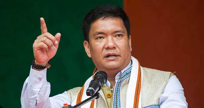
In a powerful statement, Arunachal Pradesh Chief Minister Pema Khandu drew a sharp line between historical truth and Chinese propaganda. Responding to PTI during a recent interview Khandu said: “We share a border with Tibet, not China.” His words, though simple, carried the weight of history, defiance, and a deep-rooted understanding of what Beijing has tried to erase for decades.
At a time when China is aggressively pushing its expansionist agenda illegally renaming Indian territories and releasing false maps Khandu’s declaration was a precision strike. It reasserted not only India’s territorial sovereignty but also reminded the world of Tibet’s struggle. As China tries to provoke with propaganda, the Arunachal CM’s retort reminds us that India is neither confused about its map nor afraid to speak historical truths. And more importantly, India won’t let Beijing rewrite reality.
“We Share Borders With Tibet, Not China”: Khandu’s Sharp Reply
In a bold rebuttal to Chinese territorial overreach, Arunachal Pradesh Chief Minister Pema Khandu publicly refuted the narrative that India shares a land border with China. “We share a border with Tibet, not China,” Khandu told PTI, asserting historical accuracy over geopolitical distortion. He added that Arunachal shares borders only with Bhutan, Myanmar, and Tibet, not with any part of what is originally China once.
“Officially, yes, Tibet is now under Chinese occupation. That can’t be ruled out… but originally, our international boundary has always been with Tibet,” Khandu explained. His clarification is not just semantic it’s a strategic statement that reinforces India’s rejection of Chinese claims on Arunachal Pradesh and affirms solidarity with Tibet’s original status before annexation by Mao’s regime in the 1950s.
Beijing’s Cartographic Aggression and India’s Firm Rebuttal
China has repeatedly engaged in what India calls “cartographic aggression” illegally renaming areas in Arunachal Pradesh and publishing maps that falsely claim the entire state as “Zangnan” or “Southern Tibet.” Most recently in May 2025, China attempted yet again to rename 30 places in Arunachal, a move India immediately dismissed.
“Creative naming won’t change facts,” External Affairs Ministry Spokesperson Randhir Jaiswal had earlier said. “Arunachal Pradesh was, is, and will always remain an integral and inalienable part of India.”
This follows a pattern seen in 2023 when Beijing released its so-called “standard map,” including both Arunachal Pradesh and Aksai Chin. India had hosted the G20 that year and dismissed the map as an “absurd claim.” External Affairs Minister S. Jaishankar summed it up succinctly: “Just by putting out maps… doesn’t make other people’s territories yours.”
China’s Water Weapon: Arunachal’s Real Threat
Beyond land grabs, China is also raising strategic alarms with its control of water resources originating in Tibet. The Yarlung Tsangpo river, which becomes the Brahmaputra in India, is the site of a massive Chinese hydroelectric project in Medog County. Expected to generate 60,000 MW of power, the dam poses a grave ecological and geopolitical threat to India.
Tapir Gao, BJP MP from Arunachal, dubbed the dam a “water bomb,” warning that any sudden release of water upstream could devastate Arunachal Pradesh, Assam, and even Bangladesh. Gao recalled the floods of June 2000, which he alleged were caused by similar upstream releases by China that destroyed bridges and damaged vital infrastructure in Arunachal.
To counter this, Gao called for a balancing dam within Arunachal itself—both as a strategic deterrent and as disaster preparedness against Beijing’s water games.
China’s Habit of Manufacturing Maps, India’s Habit of Dismissing Them
Chief Minister Khandu also weighed in on China’s repeated attempts to distort ground realities through its foreign policy. “We know China’s habit,” he said, referring to Beijing’s consistent strategy of making claims through maps and renaming exercises.
India has always responded with strong, unambiguous rebuttals. The Ministry of External Affairs’ position has remained consistent: Arunachal Pradesh is Indian territory by law, administration, and the will of its people.
China’s decades-long attempt to paint Arunachal as disputed territory has failed both diplomatically and on the ground. India’s infrastructure push, border deployment, and local governance initiatives in Arunachal are proof that this is no grey zone—it is red, white, green, and saffron on India’s tricolour.
India’s Map Isn’t for China to Redraw
Chief Minister Pema Khandu’s straightforward statement is a diplomatic victory in itself. When China tries to provoke with semantics and propaganda, India answers with facts and leadership. Beijing may keep releasing imaginary maps and naming exercises, but none of it alters the geography or the history.
India stands firm—not just on land but on truth. And this time, it wasn’t New Delhi or South Block that delivered the reply—it came from Itanagar, with quiet conviction and the weight of history. For China, Arunachal might be a pawn in its expansionist chessboard. For India, it’s an unshakable part of its soul.
As Khandu rightly said, “We share a border with Tibet, not China.” That single line may be more powerful than any cartographic stunt Beijing can pull off.